(Second in a series)
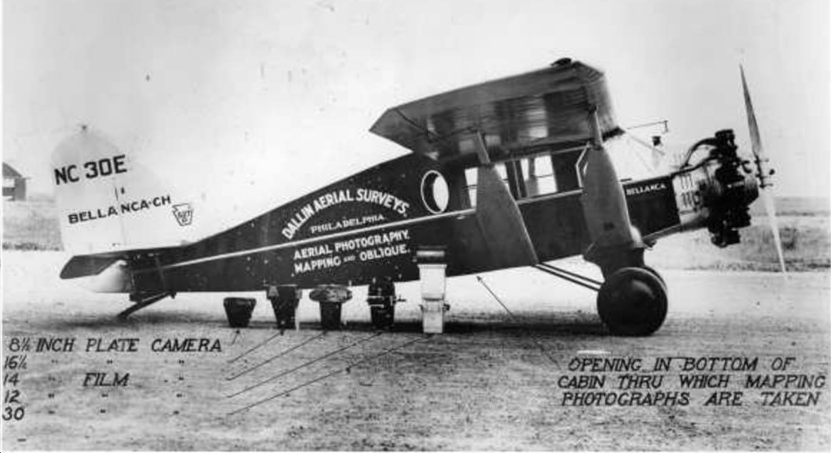
The Dallin Survey Company plane.
We previously shared with you the first in what will be a series of aerial photos taken over Schuylkill County in the 1930s. That St. Clair PA image pictured the town and nearby Pottsville, PA from thousands of feet in the air.
The special Dallin Aerial Survey Company plane, (shown at left), had an opening in the floor to allow a large-format camera to take straight-down land survey mapping images. The St. Clair image from our first post and the one below would have been taken out of the plane’s side window using the same large negative cameras.
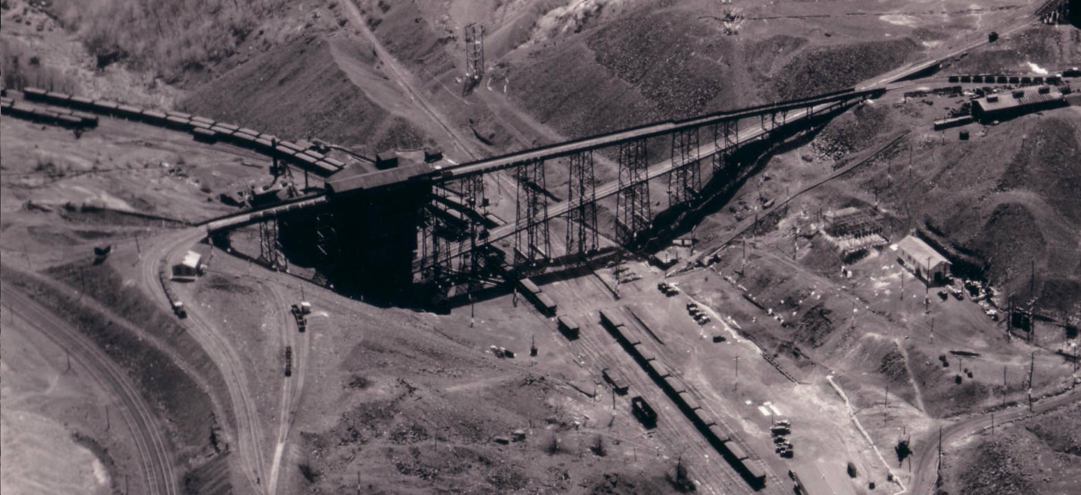
The photo below taken in May 1936, shows a coal mine in Raven Run, PA, just west of Shenandoah, with the supporting roads, rail lines and all the activity the anthracite coal operation involved.
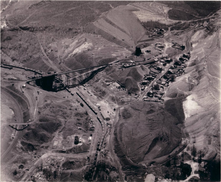
Raven Run, PA
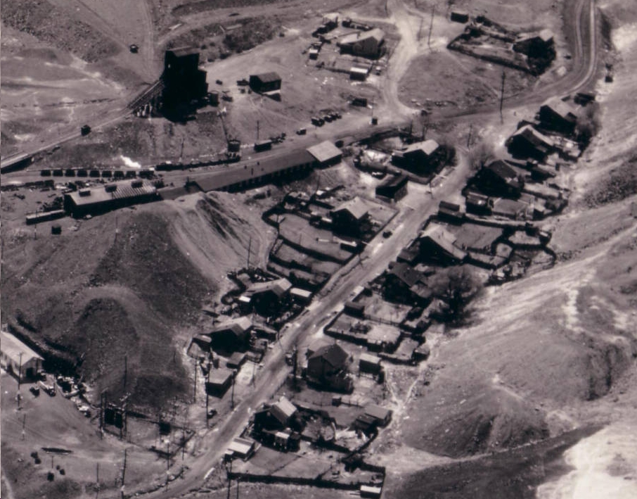
Close-up to show detail of Raven Run, PA
An even closer view of Raven Run, PA
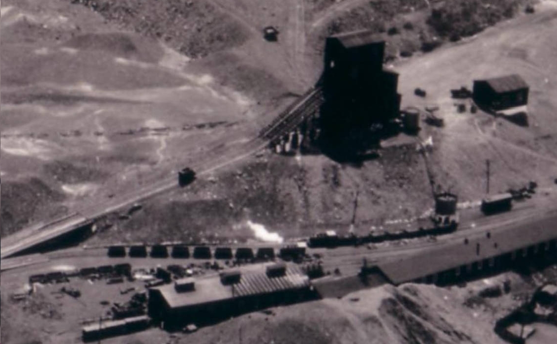
White smoke billows from a steam engine hauling eight cars of anthracite coal.
Citation:
Hagley Museum and Library Digital Archives